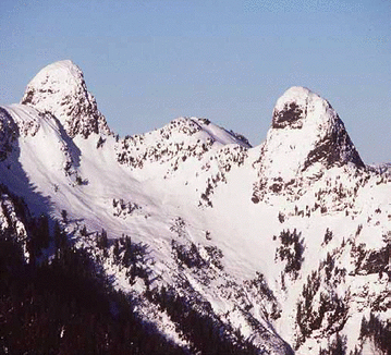
Most of Nunavut's landforms are shaped by ice sheets and glaciers. The Laurentide Ice Sheet extended north from its centre near Hudson Bay to the north side of Parry Channel, while the highlands of Ellesmere, Axel Heiberg and Devon islands supported separate ice centres with ice flowing in all directions, coalescing in many places. Except for Bathurst Island and Cornwallis Island, the low northwestern islands were not ice covered during the Wisconsin glaciation, some 18,000 years ago. However, previous ice sheets reached the Arctic Ocean coast. The spectacular valley and fiord landscape
of parts of the archipelago was shaped during the glacial periods. On Baffin Island, the Laurentide ice spilled over the height-of-land and out toward Baffin Bay, carving out deep valleys and fiords, some reaching depths of more than 900 metres. The fiords are often separated by alpine landscapes, makingthis a favored area for climbers.
of parts of the archipelago was shaped during the glacial periods. On Baffin Island, the Laurentide ice spilled over the height-of-land and out toward Baffin Bay, carving out deep valleys and fiords, some reaching depths of more than 900 metres. The fiords are often separated by alpine landscapes, makingthis a favored area for climbers.